

Drones vs traditional methods, it’s a debate playing out across industries right now. From aerial photography to package delivery, unmanned aerial vehicles (UAVs) are challenging established approaches that have dominated for decades. But are drones always the better choice? The answer depends on the specific application, budget, and desired outcome. This guide breaks down the key matchups: drones vs helicopters, drones vs satellites, and drones vs ground-based systems. By the end, readers will understand exactly where drones excel and where traditional methods still hold their ground.
Table of Contents
ToggleKey Takeaways
- Drones vs traditional methods depends on your specific application, budget, and desired outcome—there’s no universal winner.
- For aerial photography, drones offer significant cost savings and precision for low-altitude shots, while helicopters remain superior for cinema-grade productions.
- Drone surveys achieve resolution down to 1 centimeter per pixel, far exceeding satellite imagery for localized mapping and construction monitoring.
- Ground-based delivery handles high-volume shipments efficiently, but drones excel at urgent, lightweight deliveries that bypass traffic and reach remote areas.
- Many organizations achieve the best results by combining drones with traditional methods rather than choosing one over the other.
- As drone technology improves with longer flight times, increased payloads, and clearer regulations, more applications will favor UAVs over traditional approaches.
What Are Drones and How Do They Work
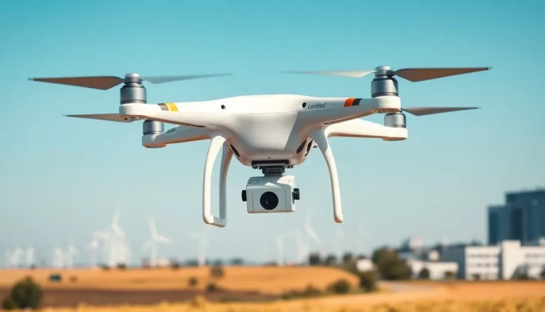
Drones are unmanned aircraft controlled remotely or through autonomous flight systems. They range from small consumer quadcopters to large industrial UAVs capable of carrying heavy payloads.
Most drones operate using four or more rotors powered by electric motors. A flight controller processes input from sensors, including GPS, accelerometers, and gyroscopes, to maintain stability. Operators control drones through handheld transmitters or software applications on tablets and smartphones.
Modern drones can carry cameras, LiDAR sensors, thermal imaging equipment, and delivery packages. Battery life typically ranges from 20 to 45 minutes for consumer models, while industrial drones using hybrid power systems can fly for several hours.
Drones communicate with ground stations through radio frequencies. Advanced models use cellular networks or satellite links for extended range operations. They process flight data in real-time, adjusting altitude, speed, and direction based on programmed parameters or operator commands.
The technology has matured significantly since the early 2010s. Today’s drones offer obstacle avoidance, automated flight paths, and return-to-home functions. These capabilities make drones vs traditional methods a genuine consideration for businesses across multiple sectors.
Drones vs Helicopters for Aerial Photography
The drones vs helicopters debate gets heated in aerial photography circles. Both have clear advantages depending on the project requirements.
Cost Comparison
Helicopter rentals typically cost $500 to $2,000 per hour, excluding crew fees. A professional photography drone costs $1,500 to $15,000 as a one-time purchase. For businesses needing frequent aerial shots, drones deliver substantial savings over time.
Image Quality and Flexibility
Helicopters can carry larger, cinema-grade cameras that produce exceptional footage. They also allow photographers to lean out and capture angles impossible with mounted cameras. But, drone cameras have improved dramatically. Models like the DJI Inspire 3 shoot 8K video and capture stills at 52 megapixels.
Drones excel at low-altitude shots, tight spaces, and smooth tracking movements. They can hover inches above water or fly through narrow corridors. Helicopters can’t match this precision, rotor wash alone makes close-up work dangerous.
Safety and Regulations
Helicopters require licensed pilots and strict adherence to aviation rules. Drones face their own regulations under the FAA Part 107 in the United States. But, drone operations carry lower risk. A crashed drone damages equipment. A helicopter incident endangers lives.
For real estate photography, event coverage, and social media content, drones win on cost and convenience. For feature films or broadcast television requiring maximum image quality, helicopters still have their place.
Drones vs Satellites for Surveying and Mapping
Surveying and mapping represent a key battleground for drones vs satellites. Each technology serves different scales and purposes.
Resolution and Accuracy
Satellite imagery typically provides resolution between 30 centimeters and 3 meters per pixel. Drone surveys achieve resolution down to 1 centimeter per pixel. For construction sites, mining operations, or agricultural analysis, this difference matters enormously.
Drones equipped with RTK (Real-Time Kinematic) GPS achieve horizontal accuracy within 2 centimeters. This precision enables volume calculations, topographic mapping, and progress monitoring that satellites simply can’t match.
Coverage Area and Speed
Satellites cover vast areas quickly. A single pass can image thousands of square kilometers. Drones work best for sites under 500 acres. Larger projects require multiple flights, battery swaps, and significant processing time.
For continental-scale environmental monitoring or global change detection, satellites remain essential. For localized, high-detail surveys, drones vs satellites is an easy call, drones win.
Cost Structure
Satellite imagery can be purchased per square kilometer, often costing $10 to $25 for archive images or $500+ for fresh captures. Drone surveys require upfront equipment investment plus operator time. Over multiple projects, drones typically prove more economical for small to medium areas.
Weather and Timing
Satellites can’t capture images through clouds. Their orbital paths also limit when specific areas can be photographed. Drones fly under cloud cover and on the operator’s schedule. This flexibility gives drones a significant advantage for time-sensitive projects.
Drones vs Ground-Based Delivery Systems
Delivery logistics represent one of the most-watched drones vs traditional methods competitions. Companies like Amazon, Wing, and Zipline are testing and deploying drone delivery networks.
Speed and Accessibility
Ground-based delivery, trucks, vans, and couriers, faces traffic, road conditions, and infrastructure limitations. A truck stuck in rush hour can’t deliver packages faster than its surroundings allow.
Drones fly direct routes. They can deliver a package 10 miles away in under 15 minutes, bypassing every red light and traffic jam. In rural areas or regions with poor road networks, drones reach locations that ground vehicles struggle to access.
Payload and Volume
Here’s where traditional methods maintain clear advantages. A delivery truck carries hundreds of packages. Current drone technology limits payloads to roughly 5 pounds for most commercial models. Some heavy-lift drones manage 20-50 pounds, but these remain expensive and rare.
For high-volume, bulk deliveries, ground transportation is far more efficient. Drones work best for urgent, lightweight, single-item deliveries.
Environmental Impact
Electric drones produce zero direct emissions during flight. Studies suggest drone delivery uses less energy per package than diesel delivery trucks, especially for distances under 10 kilometers. But, drones require batteries, and battery production carries its own environmental costs.
Ground-based electric vehicles are closing this gap. The drones vs ground delivery environmental comparison will shift as both technologies evolve.
Current Limitations
Drones can’t currently deliver in heavy rain, high winds, or extreme temperatures. They also face strict airspace regulations in urban areas. Ground delivery works in nearly all weather conditions and doesn’t require FAA approval for each route.
Choosing the Right Solution for Your Needs
The drones vs traditional methods decision comes down to specific project requirements. Here’s a practical framework for choosing.
Choose Drones When:
- The project requires high-resolution imagery or data from small to medium areas
- Budget constraints make helicopter or satellite services prohibitive
- Quick turnaround matters more than maximum coverage
- Access is difficult for ground vehicles or manned aircraft
- Repeat surveys or ongoing monitoring justify equipment investment
Choose Traditional Methods When:
- Large-scale coverage is essential (satellites for mapping, trucks for bulk delivery)
- Payloads exceed current drone capacity
- Weather conditions are unpredictable or harsh
- Regulatory restrictions limit drone operations in the target area
- Maximum image quality trumps cost considerations (cinema production)
Hybrid Approaches
Many organizations find the best answer isn’t drones vs traditional methods, it’s both. Construction companies use satellite imagery for initial site assessment, then deploy drones for detailed progress monitoring. Delivery companies route high-priority medical supplies via drone while trucks handle standard packages.
The technology continues improving. Drone flight times are extending. Payloads are increasing. Regulations are becoming clearer. What doesn’t make sense today might become the obvious choice in two years.